A Sherman Oaks neighbor campaign · Sepulveda Transit Corridor, MSF Option 1
Right Line, Wrong Yard.
Sherman Oaks supports the Sepulveda line. Just not a train yard 125 feet from our homes. Metro's Option 1 would put its train maintenance yard on the Westfield Fashion Square site — this is the plain-English briefing: what Metro has said, what it has not said, and what happens next.
The number that matters
from the site to the nearest front doors, just across Riverside Drive
the distance California's own health guidance says homes should be kept from a major rail yard
Our homes sit about eight times closer than the state's own guidance recommends.
The map: everyone inside the 1,000-foot line
We measured every home, school and playground within 1,000 feet of the yard site's boundary. Everything inside the line is marked red — and the list runs closest first.
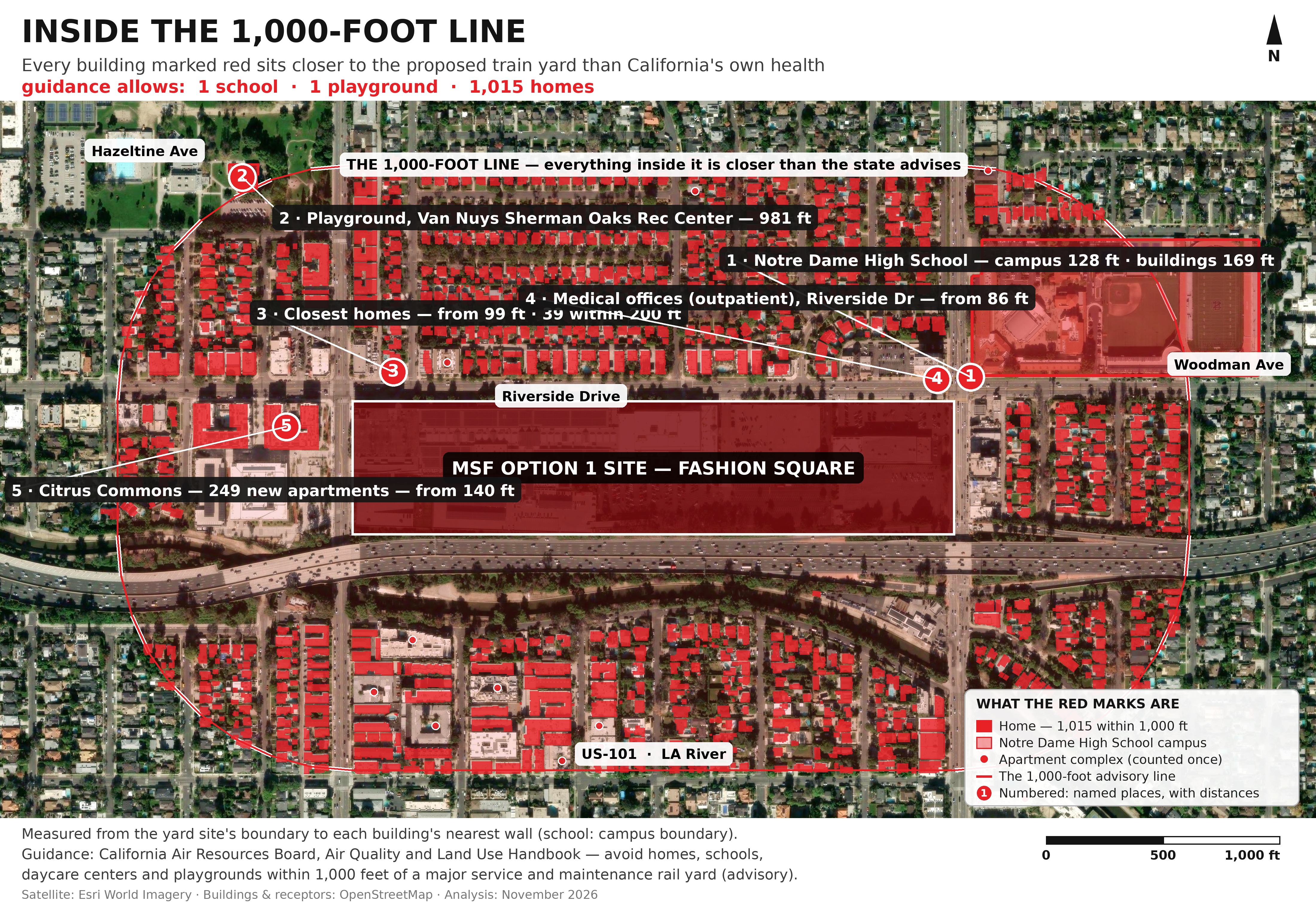
1 Homes across Riverside Drive — from 99 feet. The frontage row is the closest of all: 39 homes sit within 200 feet of the site.
2 Notre Dame High School (13609 Riverside Dr) — the campus boundary is 128 feet from the site, across Woodman Ave; its nearest school buildings are 169 feet away.
3 Citrus Commons — the new apartments at Riverside & Hazeltine — from 140 feet. Marked 5 on the map. The complex just opened: 249 apartments in two buildings, right across Hazeltine from the site's west end.
4 Homes at 201–400 feet — 118 homes.
5 Homes at 401–650 feet — 305 homes.
6 Homes at 651–1,000 feet — 553 homes — including the streets south of the 101 and the LA River.
7 Playground — Van Nuys Sherman Oaks Recreation Center — 981 feet. Inside the last band above, and broken out because it is where children play.
Total: 1,015 homes, one school and one playground inside the advisory distance. And because apartment buildings count once each, the households tell the bigger story: Citrus Commons alone holds 249 homes in 2 counted buildings, so the real figure is at least 1,262 households.
Also inside the line, marked 4 on the map: outpatient medical offices on Riverside Drive (from 86 feet) — shown but not counted, as they are not among the guidance's listed categories. Cross-checks against business listings found no daycare, preschool, nursing home or hospital within 1,000 feet. How this was measured: from the site boundary to each building's nearest wall, using OpenStreetMap building footprints (November 2026); the school is measured to its campus boundary, with the building distance shown too. Apartment buildings count once per building, and a second sweep found 14 more probable homes inside the line — so treat 1,015 as a floor, not a ceiling.
The yard, in 3D — walk through it
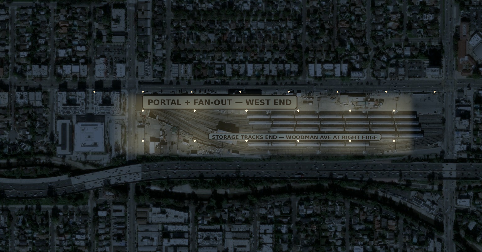
Words only go so far, so we built the yard as a 3D model on the real satellite photograph of the site. Drag to look around, scroll to zoom, tap A–E for set viewpoints, or press ▶ Walkthrough and let it fly you through. Everything the yard touches sits inside the mall lot — that is the point of building it this way.
An illustrative model, not a Metro design — Metro has published no design of its own. Tracks run west–east with the fan of tracks at the west (Hazeltine) end only, as Metro's own scoping diagram shows; the lead tracks stop at the fence because the tunnel portal's location has not been published. Shed and floodlight heights are labelled assumptions. Open the model full-screen
The wider picture: the one-mile ring
The same state guidance has a second line: within one mile of a major service and maintenance rail yard, it says limits and safeguards should be considered. So we drew that ring too — and counted everything inside it.
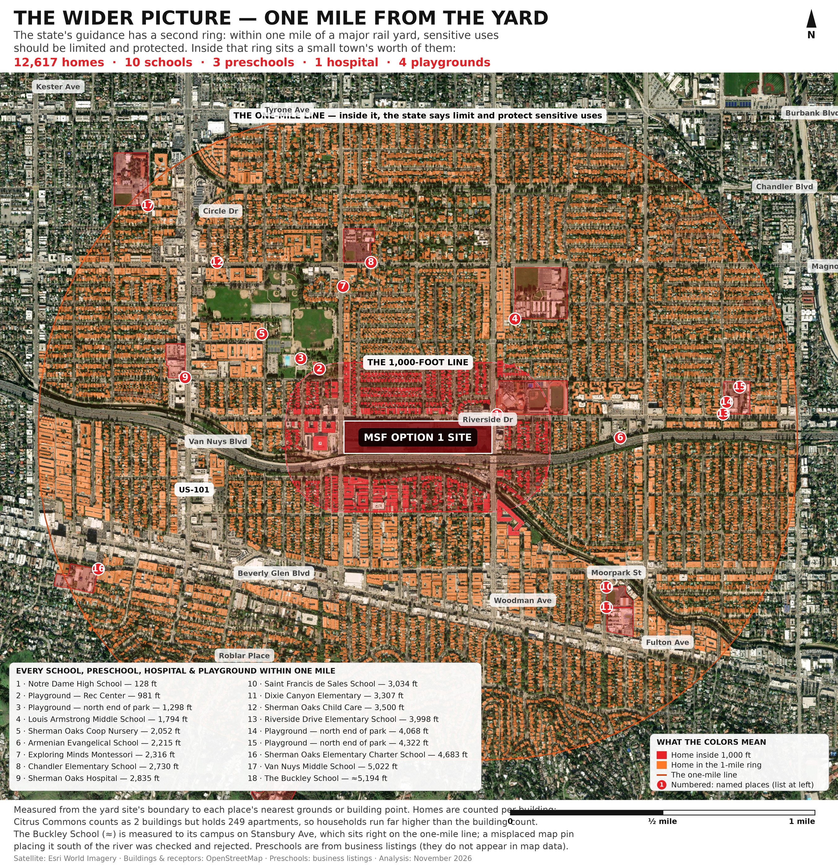
Inside one mile: 12,617 homes, 10 schools, 3 preschools, 1 hospital and 4 playgrounds.
1 Notre Dame High School — 128 feet
2 Playground, Van Nuys Sherman Oaks Recreation Center — 981 feet
3 Playground, north end of the same park — 1,298 feet
4 Louis Armstrong Middle School — 1,794 feet
5 Sherman Oaks Cooperative Nursery School — 2,052 feet
6 Armenian Evangelical School — 2,215 feet
7 Exploring Minds Montessori — 2,316 feet
8 Chandler Elementary School — 2,730 feet
9 Sherman Oaks Hospital — 2,835 feet
10 Saint Francis de Sales School — 3,034 feet
11 Dixie Canyon Elementary School — 3,307 feet
12 Sherman Oaks Child Care — 3,500 feet
13 Riverside Drive Elementary School — 3,998 feet
14 Playground — 4,068 feet
15 Playground — 4,322 feet
16 Sherman Oaks Elementary Charter School — 4,683 feet
17 Van Nuys Middle School — 5,022 feet
18 The Buckley School — about 5,194 feet, right on the one-mile line
One correction we made while checking: some map services carry a pin for a "Buckley High School" about 1,240 feet from the site. We checked — there is no school there, just houses. The real Buckley School is number 18, above.
Measured the same way as the 1,000-foot map — site boundary to each building's nearest wall, OpenStreetMap footprints (November 2026). Apartment buildings count once per building, so households run higher than the home count.
Monday night: what Metro said
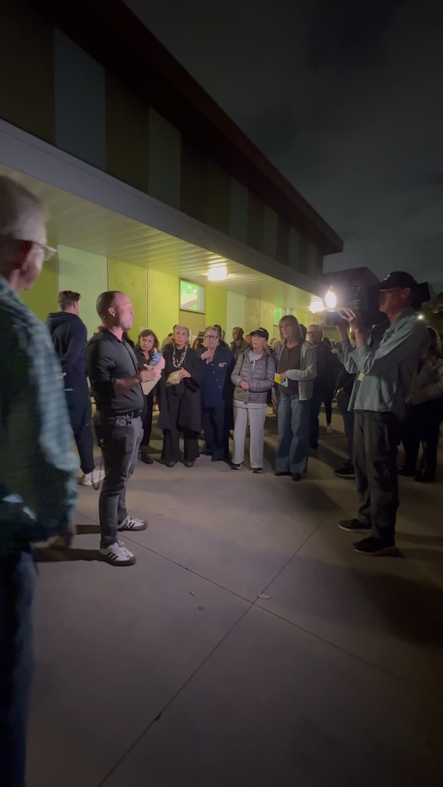
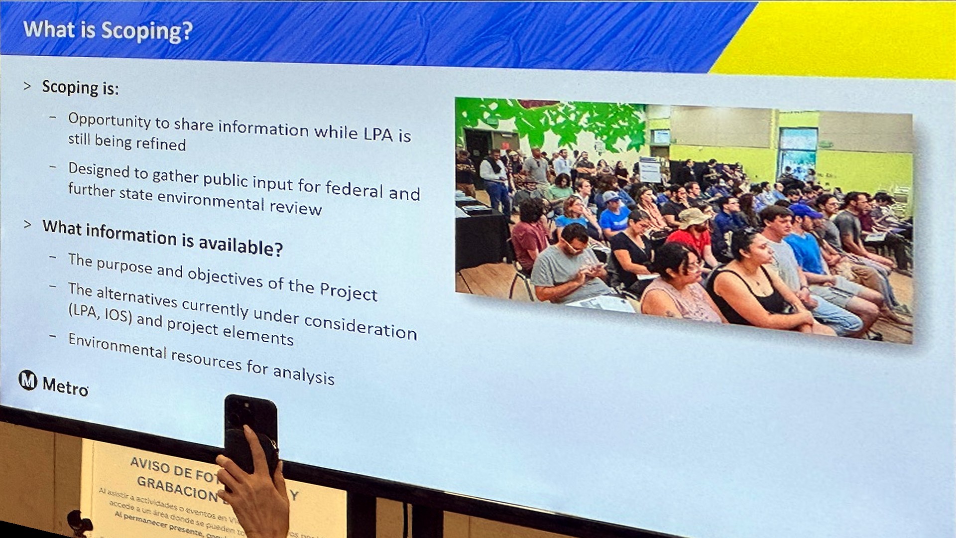
A packed hall at the Sherman Oaks East Valley Adult Center for the final scoping meeting. Here is the short version of Metro's presentation — the key points, with the actual slides they showed. (Summary drawn from the presentation and our recording of the meeting.)
The line: 12.3 miles, fully underground, 7 stations. The first phase — the Initial Operating Segment — runs from the G Line to the D Line with 4 stations: about 10 minutes from Van Nuys to Westwood.
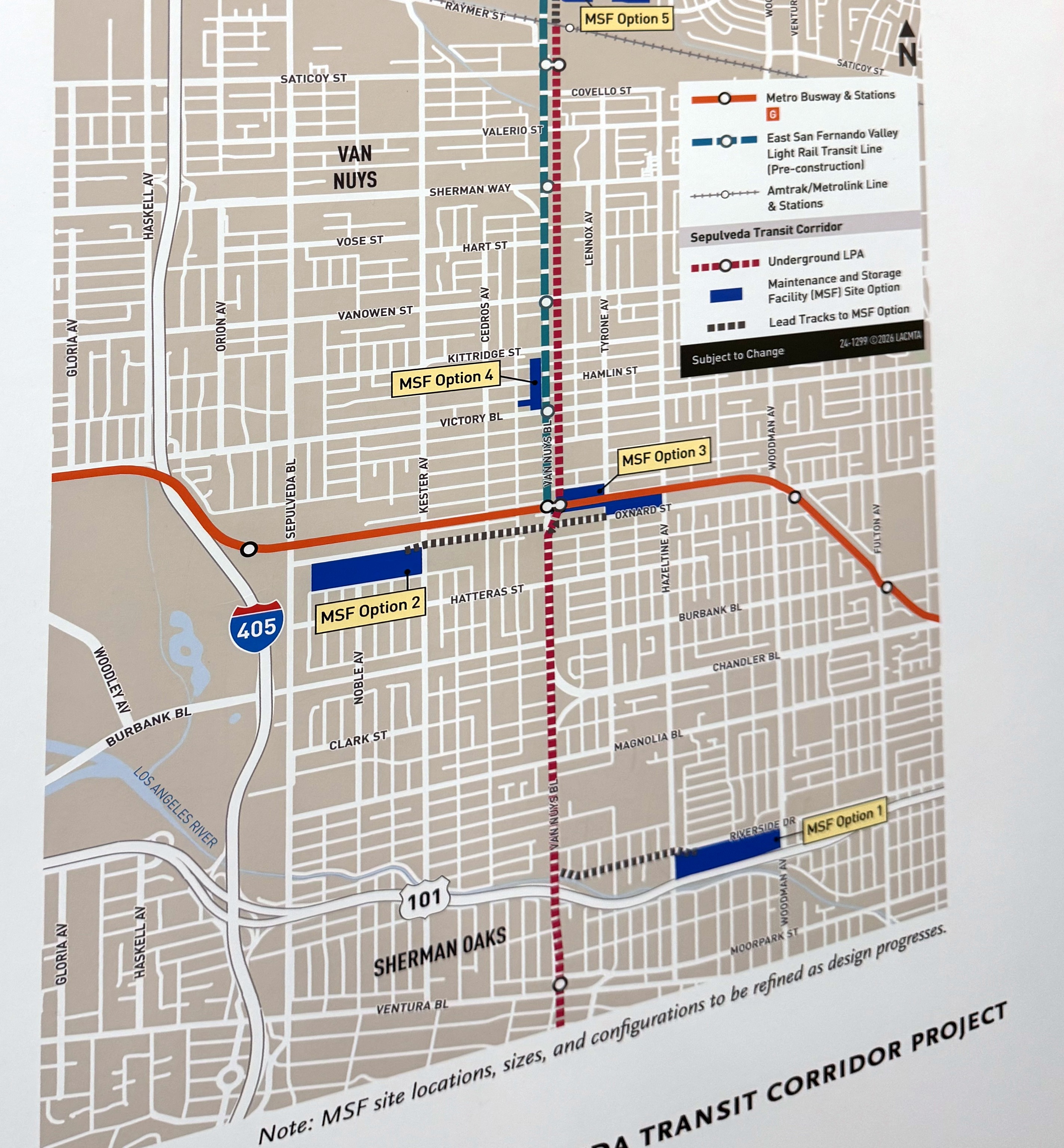
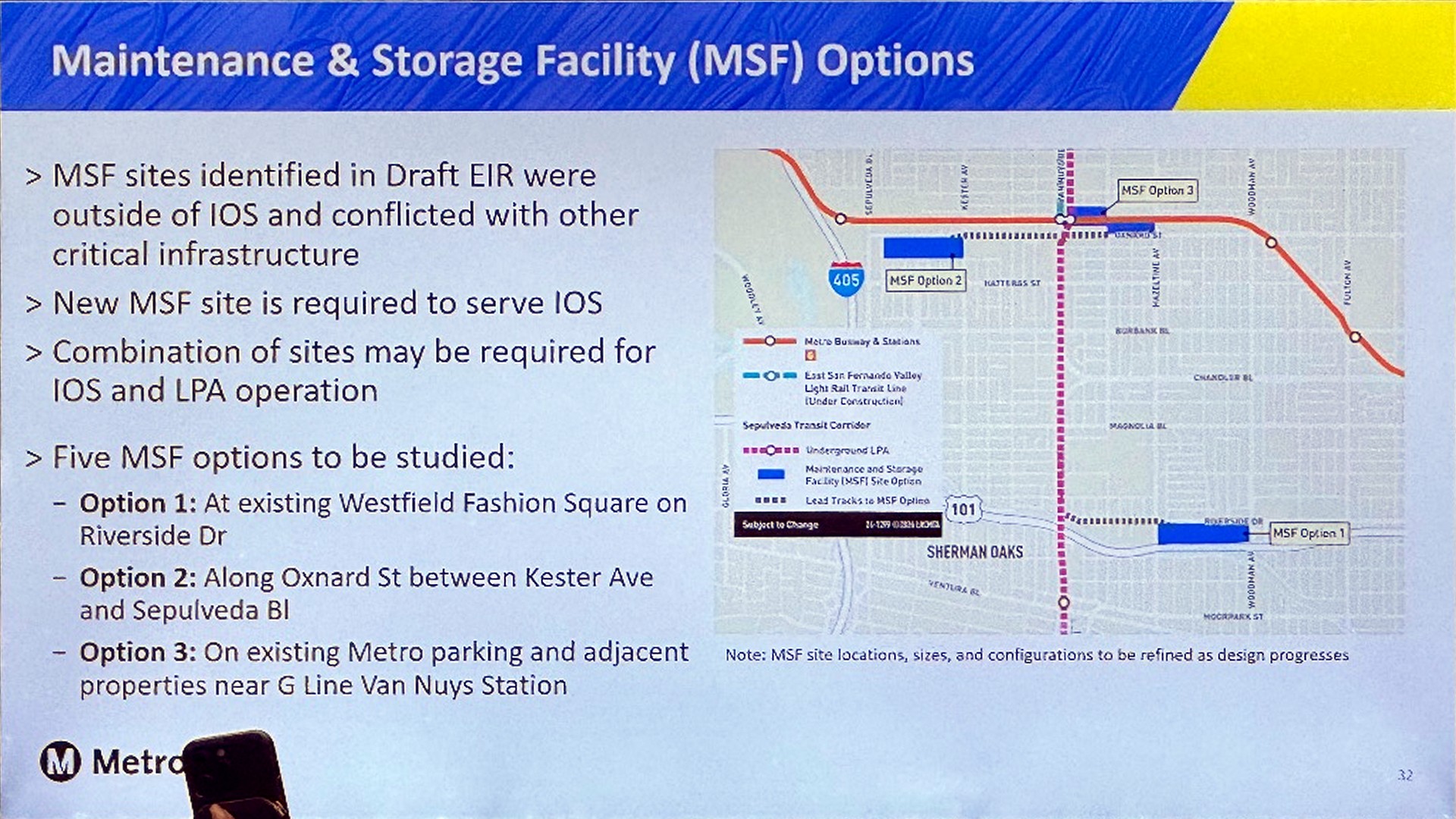
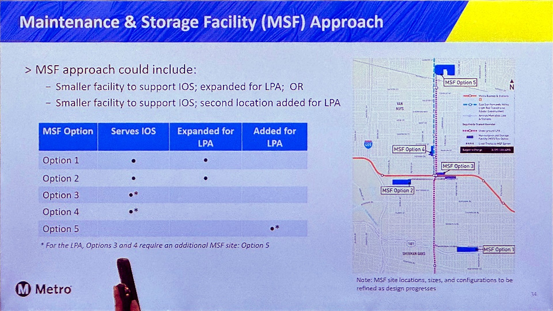
The yard sites are new. The five options were not in last year's Draft EIR. Metro stressed the numbering runs south to north — “Option 1” is not a ranking, and no site has been chosen or designed yet.
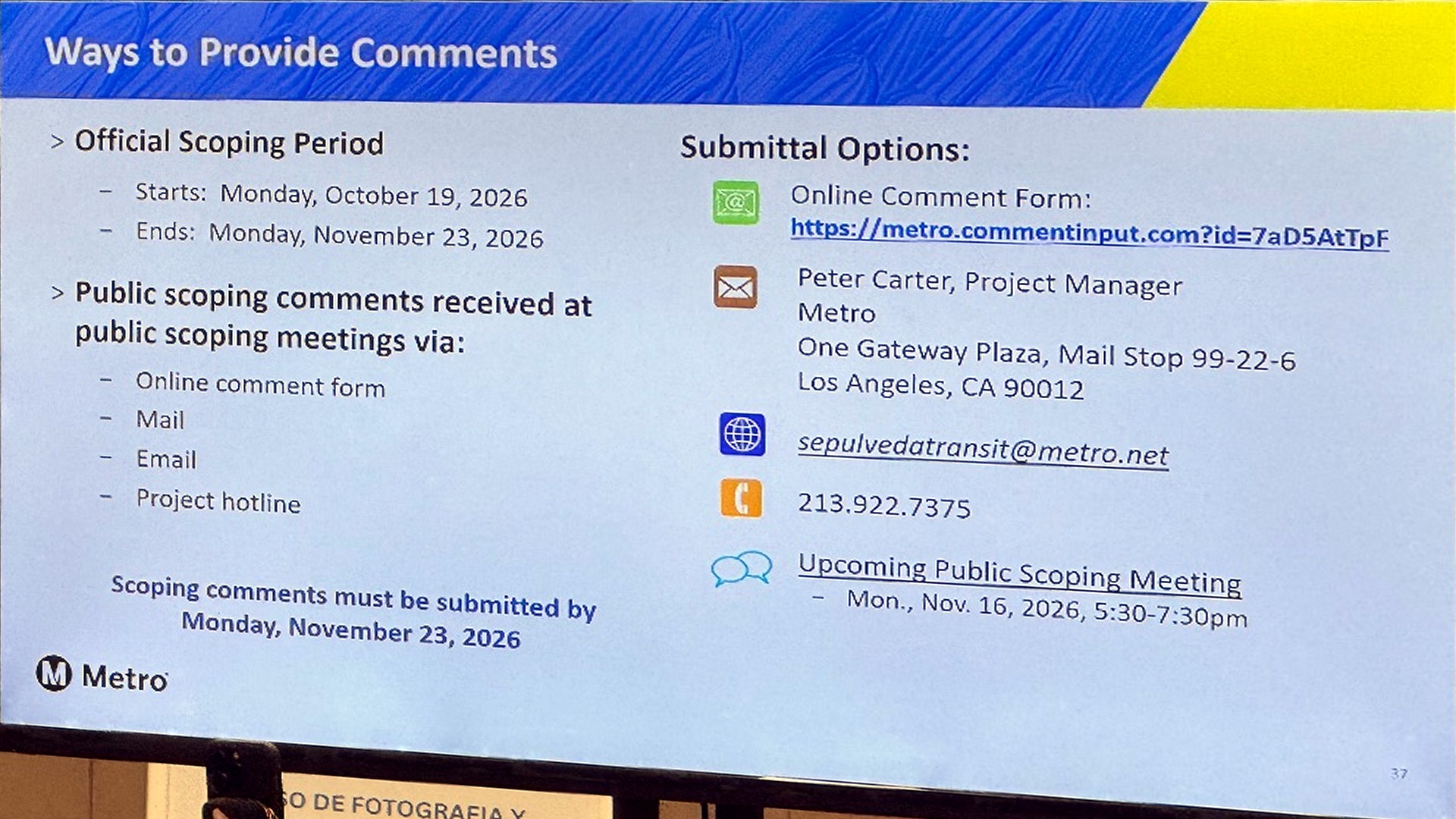
Nothing is decided. This scoping round decides what the new environmental study — a joint federal/state document, the Recirculated Draft EIR — will examine. There will be another public comment round when it is published, and Metro says it formally responds to every comment.
8,000+ people commented on the Draft EIR last year — and the Metro board then picked a combination of alternatives that hadn't been studied, which is why we are scoping again.
Writing is what counts. Comments must be in by Monday 23 November to be part of the formal record. Metro also explicitly invited neighbors to suggest other yard sites — in writing.
Why Westfield passes Metro's test
First: nobody has decided yet. Metro has not chosen a yard site. Westfield is one of five new options — listed first, but that is not a ranking. Still, it is fair to ask why a shopping center in the middle of our neighborhood is on the list at all.
Metro is judging sites like an engineer, not like a neighbor. On that test, Westfield scores well:
It is big enough in one piece. About 28.8 acres, flat and rectangular — room for the first phase, with space to grow later. Some other options are too small on their own.
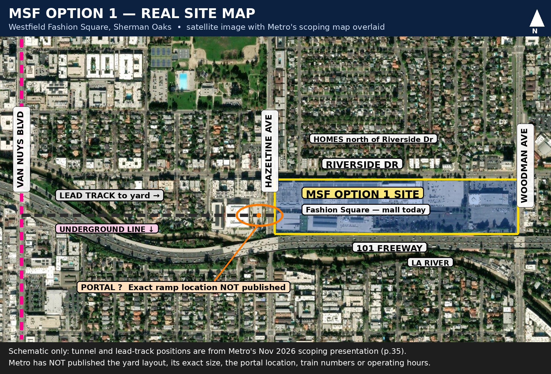
It is close to the tunnel. The trains will run underground beneath Van Nuys Blvd. A yard has to come up to the surface somewhere nearby — from Westfield, the link track is only about half a mile.
It is easy to buy. It is already commercial land, mostly parking lots, with only a few owners to deal with. No long fight to buy dozens of small plots.
It looks good for building work. Frontage on the 101 and Riverside Drive means big trucks and equipment can get in and out.
125 feet vs 1,000 feet: why that gap matters
The 1,000 feet is not a number neighbors made up. It comes from the California Air Resources Board — the state's air-quality agency — whose handbook advises keeping homes, schools, daycare centers and playgrounds at least 1,000 feet from a major service and maintenance rail yard. The reason is exposure: pollution from a yard drops sharply with distance — by as much as 80% across that separation. Distance is the protection.
Two honest points. The handbook is guidance, not a ban — it does not make Westfield illegal. And it was written about not building new homes next to a yard; here the homes were here first, and the yard would come to them. The exposure it warns about is exactly the same.
That is why this site does not work. A site that starts about eight times inside the state's own health buffer is not a close call. Unless Metro can show, in public, how people living 125 feet away would be protected, Option 1 is not a realistic site — whatever it looks like on an engineer's map.
How did we get here?
The first plan put the yard on industrial land. In the June 2025 draft study, the yard sites sat east of Van Nuys Metrolink station — including water-board land and industrial land on Orion Avenue. That is the kind of land most of us would expect a train yard to go on.
Then those sites were dropped. Metro says they were outside the first phase of the line, and clashed with other big projects there — a planned water facility, and room Metrolink needs to grow its own tracks.
So Metro started again. In January 2026 its Board told staff to find a new yard strategy. The five new sites — Westfield included — came out of that work.
EIR — the impact study
By law, Metro must study the effects first: noise, traffic, air, homes and businesses. The public gets to comment before anything is approved. Because the yard sites are new, that study is being redone.
IOS — the first phase
The line will be built in stages. The first stage runs from the G Line at Van Nuys to Westwood — 4 stations. The yard must be reachable from that first stage, which is why the old Metrolink sites no longer worked.
What Metro has NOT published
For the five new sites, Metro has published the list — and almost nothing behind it.
No long list. We do not know which other sites were looked at — including which industrial sites.
No rules. The tests or scoring used to pick the five have not been published.
No rejects, with reasons. There is no public note explaining why each other site failed.
No side-by-side comparison. Nothing in public weighs noise, air and night working at Westfield against an industrial site further from homes.
That paperwork may exist. But until it is public, none of us can check the choice. Asking for it is not opposing the train line. It is asking Metro to show its working.
Eight questions for Metro
These were the questions neighbors took to the meeting. They work just as well in a written comment — pick one or two, keep it short and polite, and ask for the answer in writing.
1 California's guidance says homes should not be within 1,000 feet of a major rail yard. Our homes are about 125 feet away. Why is this site still on the list?
2 Which industrial sites were looked at for this yard, and why was each one ruled out?
3 Will you publish the full list of sites you considered, and the tests you used to judge them?
4 What will you measure — noise, light, air, night working — at homes 125 feet away, before you decide?
5 Why does “no homes demolished” count more than the homes right across the road who would live with it every day?
6 The first plan put the yard on industrial land. What changed — and where is that explained in writing?
7 If Westfield is chosen, what would run there at night, and what limits would neighbors actually be able to enforce?
8 When will the full comparison of all five sites be published, so we can comment on it before a decision is made?
Latest updates
Newest first. This page is updated every day while the campaign is live.
What Metro said on Monday night — the short version
The key points from Metro's presentation, with the actual slides they showed: the five yard sites are new, the numbering isn't a ranking, nothing is decided — and comments in writing by Monday 23 November are what count. Read it in the meeting summary below — with photos and video from the night.
A packed hall — and this campaign has a name: Save Fashion Square
Sherman Oaks turned out in force for Metro's final scoping meeting tonight — a full hall at the East Valley Adult Center, and neighbor after neighbor making the same point: we support the Sepulveda line; it's this yard site that's wrong. The campaign now has a name — Save Fashion Square, tagline Right Line, Wrong Yard — and this page will carry every update from here as Metro works toward a decision. What matters now is the written record: comments close Monday 23 November. If you haven't sent yours, send it this week — sepulvedatransit@metro.net.
Launch day: the maps and this page
New today: the 1,000-foot map — 1,015 homes, Notre Dame High School and one playground inside the state's advisory line, at least 1,262 households counting apartment units — and the one-mile map: 12,617 homes, 10 schools, 3 preschools, Sherman Oaks Hospital and 4 playgrounds. This page launched the same day.
Neighbor discussion
Talk it over with other Sherman Oaks neighbors — what you heard at the meeting, what Metro said, what happens next. Please keep it civil and stick to facts you can source.
Put it in writing
Sign the petition
Neighbors have started a petition on Change.org — “Remove Westfield Fashion Square and Adjacent Land from Metro rail plans.” Add your name. Then send your own written comment as well: the petition shows the strength of feeling, and written comments are what Metro must answer, one by one.
Sign the petition on Change.orgWritten comments go on the record — and after Monday night's turnout, the record is where this will be decided. Metro's official deadline is Monday 23 November 2026; send yours before then and keep a copy. If you could not get an answer at the meeting, put the same question in your email and ask for a written reply.
Email your comment to Metro Download the one-page briefing (PDF)